Havana and Yale Multimodal Access Improvements Project

Share Havana and Yale Multimodal Access Improvements Project on Facebook Share Havana and Yale Multimodal Access Improvements Project on Twitter Share Havana and Yale Multimodal Access Improvements Project on Linkedin Email Havana and Yale Multimodal Access Improvements Project link
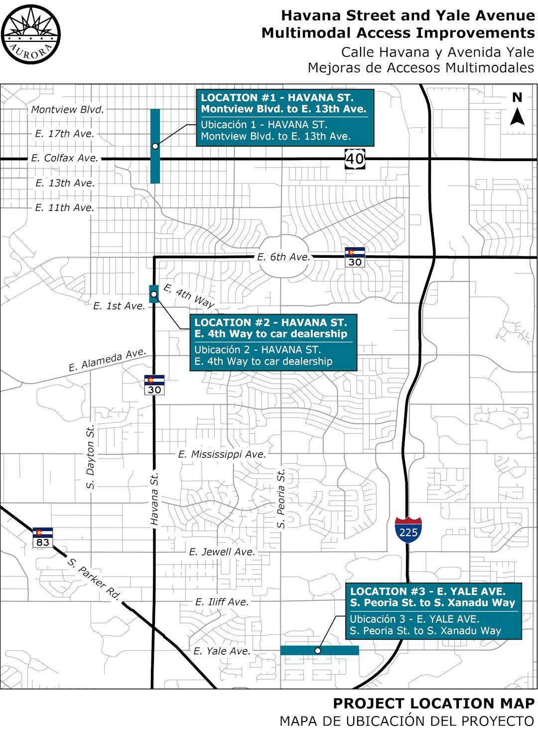
This image of an Aurora map shows three locations on Havana and Yale where sidewalks will be added or improved.

We want to hear from you

The city of Aurora is in the early phases of design of a project that will construct multimodal access improvements at three different locations along Havana Street and Yale Avenue.

Design plans for the program's first phase are nearly complete, with construction slated for 2025.

Thanks to everyone who attended our Oct. 22 open house at the Martin Luther King Jr. Library and provided feedback.

If you did not have a chance to attend the open house, opportunities for feedback are available on this webpage through Nov. 11.

View the project fact sheet.

  • Detailed Plan Map: Havana North (East 13th Avenue to Montview Boulevard)

    Share Detailed Plan Map: Havana North (East 13th Avenue to Montview Boulevard) on Facebook Share Detailed Plan Map: Havana North (East 13th Avenue to Montview Boulevard) on Twitter Share Detailed Plan Map: Havana North (East 13th Avenue to Montview Boulevard) on Linkedin Email Detailed Plan Map: Havana North (East 13th Avenue to Montview Boulevard) link
    CLOSED: This discussion has concluded.
    supporting image

    Visit this link to view a detailed roll plot for this project area that shows the area of proposed improvements and how properties will be impacted.

    Then, add any comments that you have below for this specific area or take our survey.


  • Detailed Plan Map: Havana South (East 4th Way to North of East First Avenue)

    Share Detailed Plan Map: Havana South (East 4th Way to North of East First Avenue) on Facebook Share Detailed Plan Map: Havana South (East 4th Way to North of East First Avenue) on Twitter Share Detailed Plan Map: Havana South (East 4th Way to North of East First Avenue) on Linkedin Email Detailed Plan Map: Havana South (East 4th Way to North of East First Avenue) link
    CLOSED: This discussion has concluded.
    supporting image

    Visit this link to view a detailed roll plot for this project area that shows the area of proposed improvements and how properties will be impacted.

    Then, add any comments that you have below for this specific area or take our survey.


  • Detailed Plan Map: Yale Avenue (South Peoria Street to South Xanadu Way)

    Share Detailed Plan Map: Yale Avenue (South Peoria Street to South Xanadu Way) on Facebook Share Detailed Plan Map: Yale Avenue (South Peoria Street to South Xanadu Way) on Twitter Share Detailed Plan Map: Yale Avenue (South Peoria Street to South Xanadu Way) on Linkedin Email Detailed Plan Map: Yale Avenue (South Peoria Street to South Xanadu Way) link
    CLOSED: This discussion has concluded.
    supporting image

    Visit this link to view a detailed roll plot for this project area that shows the area of proposed improvements and how properties will be impacted.

    Then, add any comments that you have below for this specific area or take our survey.


Page last updated: 12 Nov 2024, 01:00 PM